| P number: | P000267 |
|---|---|
| Old photograph number: | B00626 |
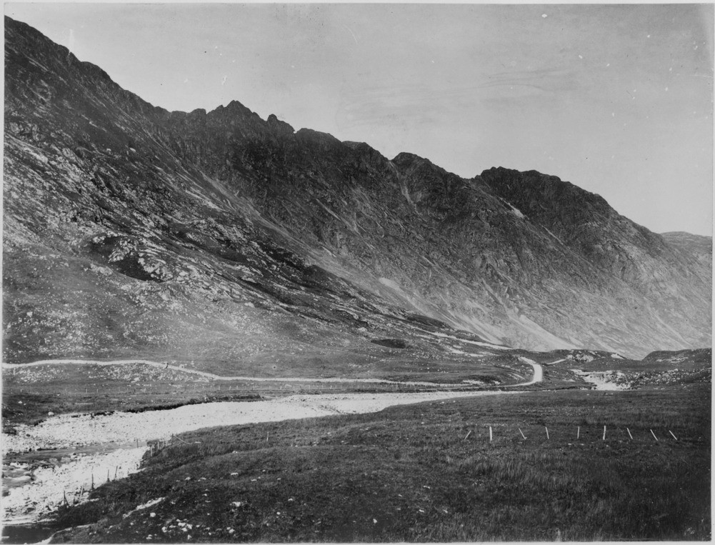
| Caption: | The full length of the Aonach Eagach ridge, the northern flank of Glen Coe. Argyllshire. The valley is typical of many glaciated valleys in the Highlands being typically U-shaped due to the erosion by glaciers. |
| Description: | The full length of the Aonach Eagach ridge, the northern flank of Glen Coe. Argyllshire. The valley is typical of many glaciated valleys in the Highlands being typically U-shaped due to the erosion by glaciers. Lower Old Red Sandstone lavas of the Glencoe Cauldron Subsidence mainly rhyolites, form the conspicuous cliff running obliquely up the slope from right to left to where they meet the Boundary Fault at the low-point of the ridge on the left. The lighter-coloured rocks to the left of the Boundary Fault consist of quartzite invaded by porphyritic granite of the Fault Intrusion. High-lying boulders of the Moor of Rannoch 'Granite' have been found on Aonach Eagach not much below 3000 feet. It is fairly certain they were picked up at c. 1000 feet and illustrate the enormous lifting power of the glaciers. |
| Date taken: | Wed Jan 01 00:00:00 GMT 1896 |
| Photographer: | Lunn, R. |
| Copyright statement: | Crown |
| Acknowledgment: | This image was digitized with grant-in-aid from SCRAN the Scottish Cultural Resources Access Network |
| X longitude/easting: | 215500 |
| Y latitude/northing: | 758500 |
| Coordinate reference system, ESPG code: | 27700 (OSGB 1936 / British National Grid) |
| Orientation: | Landscape |
| Size: | 231.62 KB; 1001 x 763 pixels; 85 x 65 mm (print at 300 DPI); 265 x 202 mm (screen at 96 DPI); |
| Average Rating: | Not yet rated |
| Categories: | Unsorted Images |
Loading...
Loading...
Reviews
There is currently no feedback