| P number: | P201120 |
|---|---|
| Old photograph number: | A01129 |
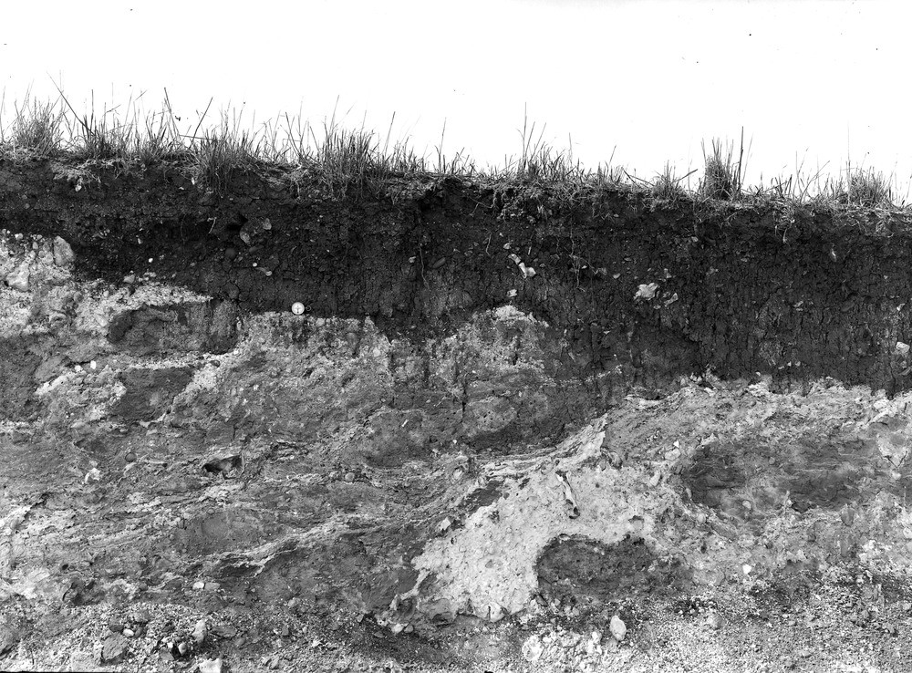
| Caption: | Baker's Hole, Northfleet. Looking NW. |
| Description: | Baker's Hole, Northfleet. Looking NW. Combe rock. The photograph shows clearly the gnarled, contorted state of the deposit and the overfolding due to flow lines formed when the sludge stream crept downhill from the adjacent high ground. This stream overwhelmed the deposits of the 50 feet terrace on which palaeolithic man had made a settlement and manufactured implements of Le Moustier type. |
| Date taken: | Sat Apr 08 00:00:00 GMT 1911 |
| Photographer: | Rhodes, J. |
| Copyright statement: | Crown |
| X longitude/easting: | 561500 |
| Y latitude/northing: | 174500 |
| Coordinate reference system, ESPG code: | 27700 (OSGB 1936 / British National Grid) |
| Orientation: | Landscape |
| Size: | 335.74 KB; 1000 x 738 pixels; 85 x 62 mm (print at 300 DPI); 265 x 195 mm (screen at 96 DPI); |
| Average Rating: | Not yet rated |
| Categories: | Unsorted Images, Geoscience subjects/ Landforms, weathering/ Coombe rock |
Loading...
Loading...
Reviews
There is currently no feedback