| P number: | P000261 |
|---|---|
| Old photograph number: | B00619 |
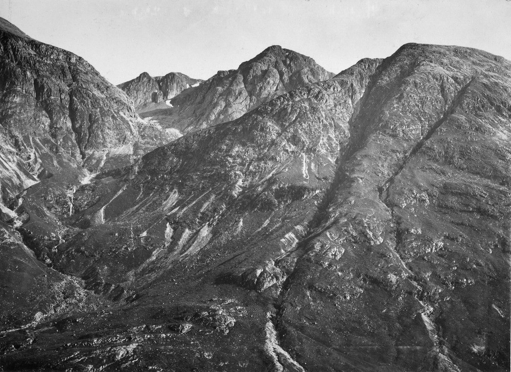
| Caption: | Coire nam Beithach, Glen Coe. Argyllshire. |
| Description: | The deep cleft on the right (An t-Sron) marks the Glen Coe Boundary Fault of the Glencoe Cauldron Subsidence. To the left are phyllites with augite-andesites on top while to the right of the fault is granite. The phyllites, an argillaceous metamorphic rock, form the base on which are overlain a range of volcanic rocks of Lower Old Red Sandstone age. They start with the augite-andesites shown and end on the top of Bidean nam Bian and the southern summit of Beinn Fhada. Agglomerate and hornblende-andesites (V), follow, the latter forming the twin summits of Bidean nam Bian (1147.88 m.) at the head of the corrie. |
| Date taken: | Wed Jan 01 00:00:00 GMT 1896 |
| Photographer: | Lunn, R. |
| Copyright statement: | Crown |
| Acknowledgment: | This image was digitized with grant-in-aid from SCRAN the Scottish Cultural Resources Access Network |
| X longitude/easting: | 215000 |
| Y latitude/northing: | 765000 |
| Coordinate reference system, ESPG code: | 27700 (OSGB 1936 / British National Grid) |
| Orientation: | Landscape |
| Size: | 297.26 KB; 1000 x 728 pixels; 85 x 62 mm (print at 300 DPI); 265 x 193 mm (screen at 96 DPI); |
| Average Rating: | Not yet rated |
| Categories: | Unsorted Images, Geoscience subjects/ Structural features/ Faulting |
Loading...
Loading...
Reviews
There is currently no feedback