| P number: | P201039 |
|---|---|
| Old photograph number: | A01048 |
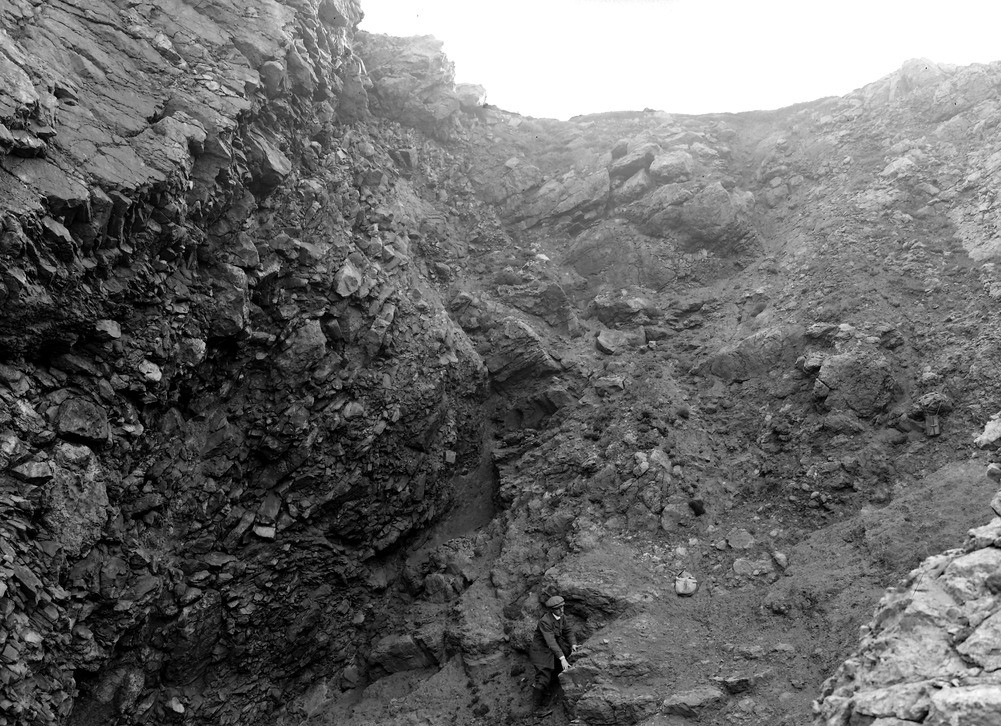
| Caption: | Bullslaughter Bay (E. side), S. of Warren. Looking ESE. |
| Description: | Bullslaughter Bay (E. side), S. of Warren. Looking ESE. A 'breccia-gash' in a region of collapse of Carboniferous Limestone. For general position in cliff and relations to the faulting in A1050 and A1051 see A1020 (similarly lettered). N is undisturbed, jointed limestone; Y is gash-breccia, separated from N by a quite indefinite boundary and from the rest of the rocks in the view by an irregular break CD. E is mudstone and F an underlying limestone; both beds are separated from the limestone (from which the bag and map-case hang) by a fault GH and are themselves step-faulted near the figure as shown in A1049. All the faults are probably slips caused by collapse. |
| Date taken: | Wed Nov 10 00:00:00 GMT 1909 |
| Photographer: | Hall, T.C. |
| Copyright statement: | Crown |
| X longitude/easting: | 194500 |
| Y latitude/northing: | 194500 |
| Coordinate reference system, ESPG code: | 27700 (OSGB 1936 / British National Grid) |
| Orientation: | Landscape |
| Size: | 316.66 KB; 1001 x 726 pixels; 85 x 61 mm (print at 300 DPI); 265 x 192 mm (screen at 96 DPI); |
| Average Rating: | Not yet rated |
| Categories: | Unsorted Images, Geoscience subjects/ Stratigraphical |
Loading...
Loading...
Reviews
There is currently no feedback