| P number: | P200938 |
|---|---|
| Old photograph number: | A00947 |
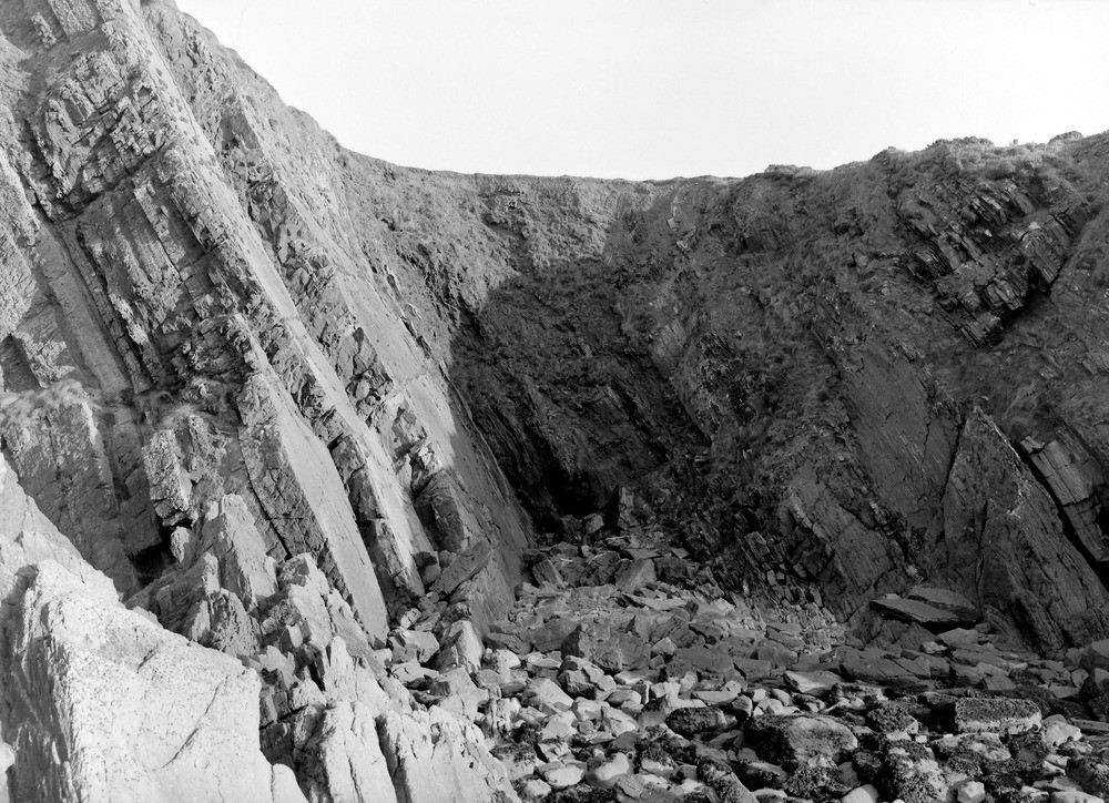
| Caption: | Cliff E. by S. of Thorn Island, Angle. Looking E. |
| Description: | Cliff E. by S. of Thorn Island, Angle. Looking E. Top of Upper Old Red Sandstone and base of Lower Limestone Shales. The lower beds are seen in A945 also. The limit between the two formations is placed at the partly broken line. The highest beds of the Upper Old Red include some marine bands, viz., #16 and th lower part of #13. The Carboniferous beds belong to the Modiola-phase, Km, of the Cleistopora Zone; they consist, in ascending order, of limestones with shales (upper part of #13); shales; and, along the right-hand margin of the view, oolites. (For 13 etc. see photograph.) |
| Date taken: | Tue Nov 16 00:00:00 GMT 1909 |
| Photographer: | Hall, T.C. |
| Copyright statement: | Crown |
| X longitude/easting: | 184500 |
| Y latitude/northing: | 203500 |
| Coordinate reference system, ESPG code: | 27700 (OSGB 1936 / British National Grid) |
| Orientation: | Landscape |
| Size: | 300.80 KB; 1000 x 724 pixels; 85 x 61 mm (print at 300 DPI); 265 x 192 mm (screen at 96 DPI); |
| Average Rating: | Not yet rated |
| Categories: | Unsorted Images, Geoscience subjects/ Stratigraphical |
Loading...
Loading...
Reviews
There is currently no feedback