| P number: | P000246 |
|---|---|
| Old photograph number: | B00305 |
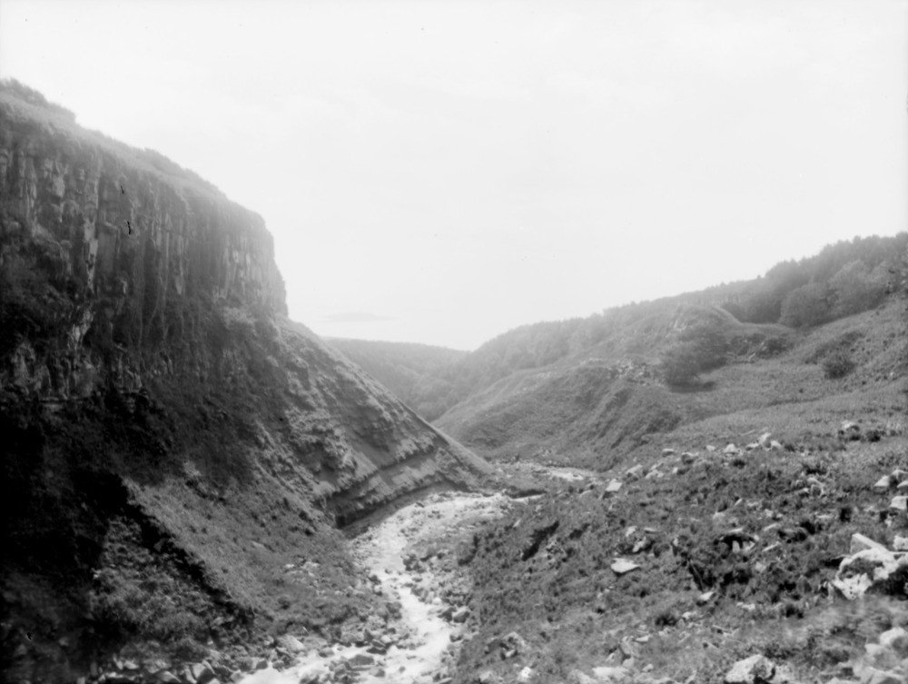
| Caption: | Eas Mor, Auchenhew Burn, 2.414 km. north-west of Kildonan Castle, south-east Arran. Looking south down the gorge below the waterfall. Buteshire. |
| Description: | Eas Mor, Auchenhew Burn, 2.414 km. north-west of Kildonan Castle, south-east Arran. Looking south down the gorge below the waterfall. Buteshire. On the left the Tertiary dolerite sill rests upon the Triassic marls, sandstones and shales. On the right several large landslips can be seen, the debris choking the stream. |
| Date taken: | Fri Jan 01 00:00:00 GMT 1897 |
| Photographer: | Lunn, R. |
| Copyright statement: | Crown |
| Acknowledgment: | This image was digitized with grant-in-aid from SCRAN the Scottish Cultural Resources Access Network |
| X longitude/easting: | 202000 |
| Y latitude/northing: | 622300 |
| Coordinate reference system, ESPG code: | 27700 (OSGB 1936 / British National Grid) |
| Orientation: | Landscape |
| Size: | 129.73 KB; 1000 x 753 pixels; 85 x 64 mm (print at 300 DPI); 265 x 199 mm (screen at 96 DPI); |
| Average Rating: | Not yet rated |
| Categories: | Unsorted Images, Geoscience subjects/ Landforms, river/ Valleys |
Loading...
Loading...
Reviews
There is currently no feedback