| P number: | P000243 |
|---|---|
| Old photograph number: | B00301 |
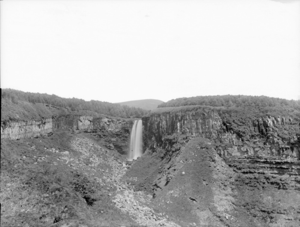
| Caption: | Eas Mor, Auchenhew Burn, 2.414 km. north-west of Kildonan Castle, south-east Arran. Looking north. Buteshire. |
| Description: | Eas Mor, Auchenhew Burn, 2.414 km. north-west of Kildonan Castle, south-east Arran. Looking north. Buteshire. Composite dolerite sill overlying Triassic marls, sandstones and shales, giving rise to waterfall and landslips by the undermining of the softer sedimentary rocks. The waterfall has created an amphitheatre-shaped gorge. |
| Date taken: | Fri Jan 01 00:00:00 GMT 1897 |
| Photographer: | Lunn, R. |
| Copyright statement: | Crown |
| Acknowledgment: | This image was digitized with grant-in-aid from SCRAN the Scottish Cultural Resources Access Network |
| X longitude/easting: | 202000 |
| Y latitude/northing: | 622300 |
| Coordinate reference system, ESPG code: | 27700 (OSGB 1936 / British National Grid) |
| Orientation: | Landscape |
| Size: | 142.53 KB; 1000 x 756 pixels; 85 x 64 mm (print at 300 DPI); 265 x 200 mm (screen at 96 DPI); |
| Average Rating: | Not yet rated |
| Categories: | Unsorted Images, Geoscience subjects/ Igneous features/ Sills, Geoscience subjects/ Landforms, river/ Waterfalls and pot-holes |
Loading...
Loading...
Reviews
There is currently no feedback