| P number: | P000234 |
|---|---|
| Old photograph number: | B00231 |
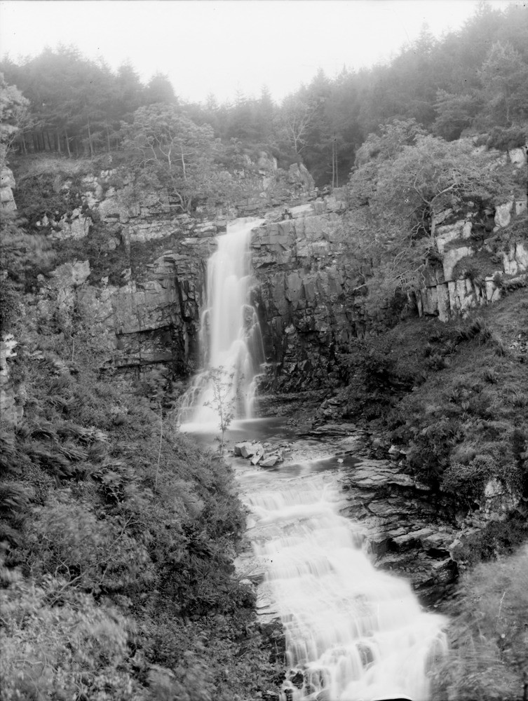
| Caption: | Glenashdale Falls, 2.146 km. west of Whiting Bay, south-east coast of Arran. Buteshire. A Tertiary dolerite sill intruded into Triassic sandstones, dipping upstream and giving rise to a waterfall. |
| Description: | Glenashdale Falls, 2.146 km. west of Whiting Bay, south-east coast of Arran. Buteshire. A Tertiary dolerite sill intruded into Triassic sandstones, dipping upstream and giving rise to a waterfall. The view shows part of the Glenashdale composite sill. It is estimated to be about 64 metres thick in total and is formed of a lower felsite, the main quartz-dolerite, a feldspathic quartz-dolerite or craignurite and a upper felsite with sediment intercalations. |
| Date taken: | Fri Jan 01 00:00:00 GMT 1897 |
| Photographer: | Lunn, R. |
| Copyright statement: | Crown |
| Acknowledgment: | This image was digitized with grant-in-aid from SCRAN the Scottish Cultural Resources Access Network |
| X longitude/easting: | 202400 |
| Y latitude/northing: | 624800 |
| Coordinate reference system, ESPG code: | 27700 (OSGB 1936 / British National Grid) |
| Orientation: | Portrait |
| Size: | 238.51 KB; 753 x 1000 pixels; 64 x 85 mm (print at 300 DPI); 199 x 265 mm (screen at 96 DPI); |
| Average Rating: | Not yet rated |
| Categories: | Unsorted Images, Geoscience subjects/ Landforms, river/ Waterfalls and pot-holes |
Loading...
Loading...
Reviews
There is currently no feedback