| P number: | P000224 |
|---|---|
| Old photograph number: | D05107 |
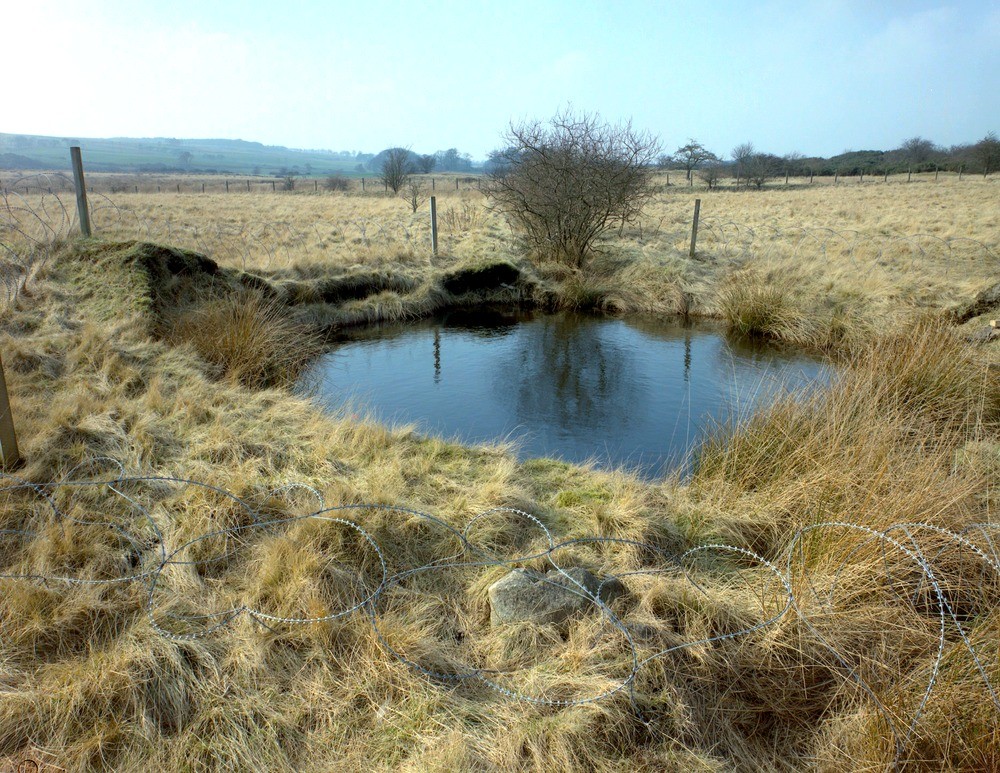
| Caption: | South Drum, near High Bonnybridge. Central Region. Crown hole caused by fireclay mining. |
| Description: | South Drum, near High Bonnybridge. Central Region. Crown hole caused by fireclay mining. Large crown hole or pit superimposed on much larger area of subsidence caused by collapse of the stoop and room workings in the Upper Bonnybridge Fireclay (Lower Leaf) in 1953, during the life of the Drum Mine. The roof of the workings was approximately 16 m. below the surface. |
| Date taken: | Fri Jan 01 00:00:00 GMT 1993 |
| Photographer: | McTaggart, F.I. |
| Copyright statement: | NERC |
| Acknowledgment: | This image was digitized with grant-in-aid from SCRAN the Scottish Cultural Resources Access Network |
| X longitude/easting: | 283380 |
| Y latitude/northing: | 677800 |
| Coordinate reference system, ESPG code: | 27700 (OSGB 1936 / British National Grid) |
| Orientation: | Landscape |
| Size: | 340.41 KB; 1000 x 773 pixels; 85 x 65 mm (print at 300 DPI); 265 x 205 mm (screen at 96 DPI); |
| Average Rating: | Not yet rated |
| Categories: | Unsorted Images |
Loading...
Loading...
Reviews
There is currently no feedback