| P number: | P000211 |
|---|---|
| Old photograph number: | D04851 |
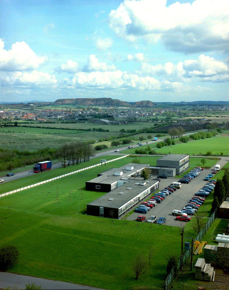
| Caption: | Broxburn, West Lothian, viewed from Stankards Bing. General view of Broxburn area showing mixed land-use, industrial, housing, agricultural, transport, backed by spent oil-shale in Broxburn Bings. |
| Description: | Broxburn, West Lothian, viewed from Stankards Bing. General view of Broxburn area showing mixed land-use, industrial, housing, agricultural, transport, backed by spent oil-shale in Broxburn Bings. Oil-shale was first discovered as a raw material for the production of shale-oil in West Lothian in the 1850s. It was mined in the area from then until the 1960s. Since then a diverse range of alternative land use has arisen, with the bing, spent oil-shale waste product, forming a constant reminder of the dominant former industry of the area. |
| Date taken: | Thu Oct 01 00:00:00 BST 1992 |
| Photographer: | McTaggart, F.I. |
| Copyright statement: | NERC |
| Acknowledgment: | This image was digitized with grant-in-aid from SCRAN the Scottish Cultural Resources Access Network |
| X longitude/easting: | 307500 |
| Y latitude/northing: | 672500 |
| Coordinate reference system, ESPG code: | 27700 (OSGB 1936 / British National Grid) |
| Orientation: | Portrait |
| Size: | 250.82 KB; 790 x 1000 pixels; 67 x 85 mm (print at 300 DPI); 209 x 265 mm (screen at 96 DPI); |
| Average Rating: | Not yet rated |
| Categories: | Unsorted Images |
Loading...
Loading...
Reviews
There is currently no feedback