| P number: | P200472 |
|---|---|
| Old photograph number: | A00478 |
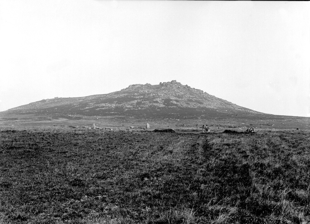
| Caption: | Roughtor, (S. side), Camelford. Looking N. |
| Description: | Roughtor, (S. side), Camelford. Looking N. Granite hill. A 'tor'. In the foreground is an ancient stone arch. This is the second highest eminence in Cornwall and is 1312 feet above sea level. Even at this distance, the horizontal weathering of the granite (imparting a bedded aspect) is well seen by aid of a hand lens. On the left side of the hill the structure is parallel to the hill slope, a rather unusual phenomenon. |
| Date taken: | Tue Jan 01 00:00:00 GMT 1907 |
| Photographer: | Hall, T.C. |
| Copyright statement: | Crown |
| X longitude/easting: | 214500 |
| Y latitude/northing: | 80500 |
| Coordinate reference system, ESPG code: | 27700 (OSGB 1936 / British National Grid) |
| Orientation: | Landscape |
| Size: | 245.49 KB; 1001 x 724 pixels; 85 x 61 mm (print at 300 DPI); 265 x 192 mm (screen at 96 DPI); |
| Average Rating: | Not yet rated |
| Categories: | Unsorted Images, Geoscience subjects/ Landforms, weathering/ Weathering along bedding. Joints, cleavage |
Loading...
Loading...
Reviews
There is currently no feedback