| P number: | P200346 |
|---|---|
| Old photograph number: | A00352 |
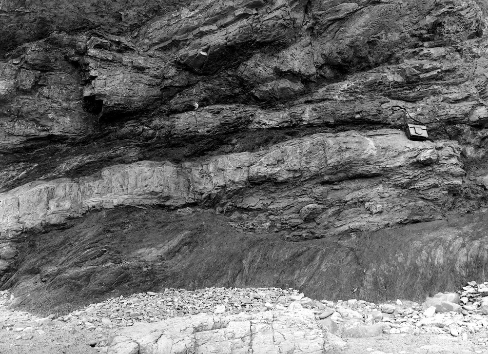
| Caption: | 150 yd. E. of the harbour, Saundersfoot. Looking SW. |
| Description: | 150 yd. E. of the harbour, Saundersfoot. Looking SW. Coal Measures. Alternation of 'dilsh' with bands of unbroken clays and sandstones. The 'dilsh' is a completely ground up, and rearranged whole. Section descending: sandstone forning the upper half of the photo; coal 7 in.; dilsh black schist on coal in small lenticular fragments 2'; dark underclay; light underclay 1.00ft. |
| Date taken: | Mon Jan 01 00:00:00 GMT 1906 |
| Photographer: | Hall, T.C. |
| Copyright statement: | Crown |
| X longitude/easting: | 213500 |
| Y latitude/northing: | 204500 |
| Coordinate reference system, ESPG code: | 27700 (OSGB 1936 / British National Grid) |
| Orientation: | Landscape |
| Size: | 379.09 KB; 1001 x 726 pixels; 85 x 61 mm (print at 300 DPI); 265 x 192 mm (screen at 96 DPI); |
| Average Rating: | Not yet rated |
| Categories: | Unsorted Images, Geoscience subjects/ Stratigraphical |
Loading...
Loading...
Reviews
There is currently no feedback