| P number: | P200331 |
|---|---|
| Old photograph number: | A00337 |
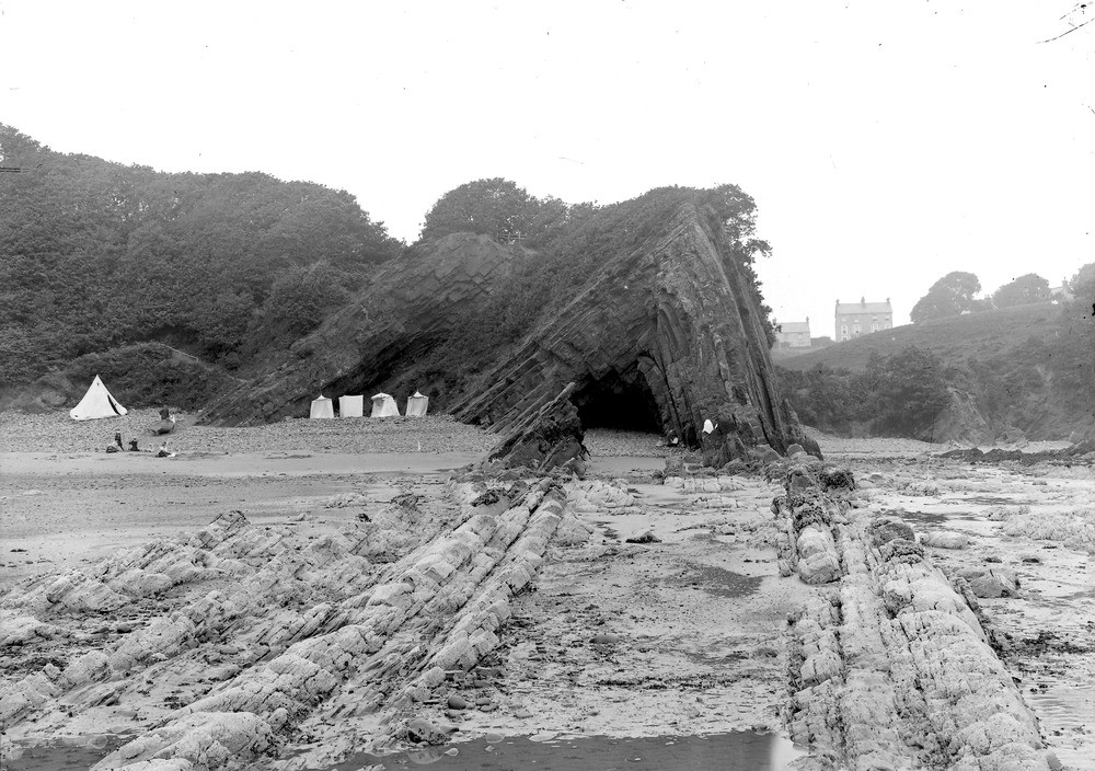
| Caption: | 370 yd. S. of Harbour, Saundersfoot. Looking W. |
| Description: | 370 yd. S. of Harbour, Saundersfoot. Looking W. Anticline in Coal Measures. A sharp anticline, showing the steeper dip in the right (northern) limb. An equally sharp syncline underlies the hollow to the right, and the rocks on the extreme right dip southwards (towards the left). Coal Measures with thin coal seams (the Stanners veins), veins, crop out to the left. The left-hand margin of this photo almost coincides with the right-hand margin of A334. |
| Date taken: | Mon Jan 01 00:00:00 GMT 1906 |
| Photographer: | Hall, T.C. |
| Copyright statement: | Crown |
| X longitude/easting: | 213500 |
| Y latitude/northing: | 204500 |
| Coordinate reference system, ESPG code: | 27700 (OSGB 1936 / British National Grid) |
| Orientation: | Landscape |
| Size: | 252.81 KB; 1000 x 704 pixels; 85 x 60 mm (print at 300 DPI); 265 x 186 mm (screen at 96 DPI); |
| Average Rating: | Not yet rated |
| Categories: | Unsorted Images, Geoscience subjects/ Structural features/ Folding |
Loading...
Loading...
Reviews
There is currently no feedback