| P number: | P000176 |
|---|---|
| Old photograph number: | C03859 |
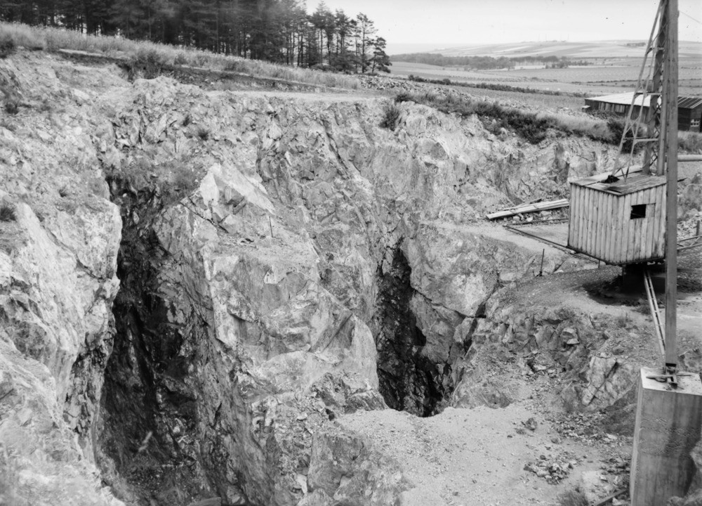
| Caption: | Quarry at Damheads, 366 m. west by north of Damheads, 2.4 km. south-south-west of Portsoy. Banffshire. General view showing deep opencast excavations along talc veins in serpentine. |
| Description: | Quarry at Damheads, 366 m. west by north of Damheads, 2.4 km. south-south-west of Portsoy. Banffshire. General view showing deep opencast excavations along talc veins in serpentine. This serpentine forms the most northern exposure of a narrow belt that extends southwards to the Knock Hill. This belt, always to the east of the Durn Hill Quartzite ridge is over five miles in length and never more than a quarter of a mile in width. To the right is a crane. One stay in the foreground (right) is fixed to a concrete block. The talc extracted was of excellent quality and pieces as large as a fist were obtainable, however it was not available in sufficient quantities to quarry on a large scale. |
| Date taken: | Mon Jan 01 00:00:00 BST 1945 |
| Photographer: | Fisher, W.D. |
| Copyright statement: | Crown |
| Acknowledgment: | This image was digitized with grant-in-aid from SCRAN the Scottish Cultural Resources Access Network |
| X longitude/easting: | 357500 |
| Y latitude/northing: | 863500 |
| Coordinate reference system, ESPG code: | 27700 (OSGB 1936 / British National Grid) |
| Orientation: | Landscape |
| Size: | 252.68 KB; 1000 x 720 pixels; 85 x 61 mm (print at 300 DPI); 265 x 190 mm (screen at 96 DPI); |
| Average Rating: | Not yet rated |
| Categories: | Unsorted Images |
Loading...
Loading...
Reviews
There is currently no feedback