| P number: | P000170 |
|---|---|
| Old photograph number: | C03840 |
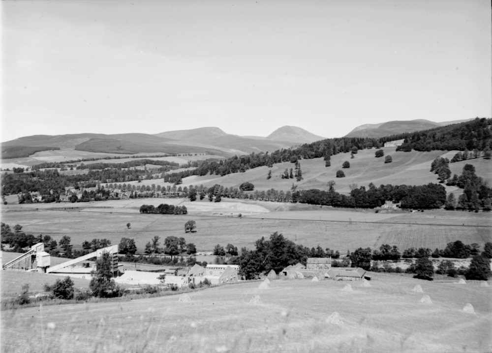
| Caption: | Shierglas Quarry, 1 mile south-east of Blair Atholl and 2 miles west-north-west of Killiecrankie Station. Perthshire. View from the quarry showing the Garry Valley in the foreground and fault feature of Glen Tilt in the background. |
| Description: | Shierglas Quarry, 1 mile south-east of Blair Atholl and 2 miles west-north-west of Killiecrankie Station. Perthshire. View from the quarry showing the Garry Valley in the foreground and fault feature of Glen Tilt in the background. The lower processing plant and Shierglas Farm with Blair Atholl middle left. The large house on the opposite slope is Lude House. Note the hayricks in the foreground. |
| Date taken: | Mon Jan 01 00:00:00 BST 1945 |
| Photographer: | Fisher, W.D. |
| Copyright statement: | Crown |
| Acknowledgment: | This image was digitized with grant-in-aid from SCRAN the Scottish Cultural Resources Access Network |
| X longitude/easting: | 288500 |
| Y latitude/northing: | 763500 |
| Coordinate reference system, ESPG code: | 27700 (OSGB 1936 / British National Grid) |
| Orientation: | Landscape |
| Size: | 146.60 KB; 1000 x 718 pixels; 85 x 61 mm (print at 300 DPI); 265 x 190 mm (screen at 96 DPI); |
| Average Rating: | Not yet rated |
| Categories: | Unsorted Images |
Loading...
Loading...
Reviews
There is currently no feedback