| P number: | P000154 |
|---|---|
| Old photograph number: | C03788 |
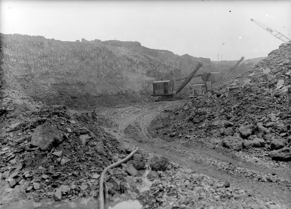
| Caption: | Nether Cairn Site, 4.0 km. west of Kirkconnel. Dumfriesshire. Opencast coal production. General view of excavation showing the Carboniferous Coal Measures, Kirkconnel Splint Coal and overburden of shales and boulder clay. |
| Description: | Nether Cairn Site, 4.0 km. west of Kirkconnel. Dumfriesshire. Opencast coal production. General view of excavation showing the Carboniferous Coal Measures, Kirkconnel Splint Coal and overburden of shales and boulder clay. Shovel excavator removing coal and loading into a lorry in centre of the view. The coal seam was c. 4 ft. 6 in. thick. Mining in the Sanquhar Coalfield has a history extending to the 1700's. It was extensively mined in those parts of the coalfield where the coals were near the surface by many shallow sinkings and pits. Deeper mining in the Kirkconnel area began in 1895 at Fauldhead Colliery. |
| Date taken: | Mon Jan 01 00:00:00 BST 1945 |
| Photographer: | Fisher, W.D. |
| Copyright statement: | Crown |
| Acknowledgment: | This image was digitized with grant-in-aid from SCRAN the Scottish Cultural Resources Access Network |
| X longitude/easting: | 269500 |
| Y latitude/northing: | 612500 |
| Coordinate reference system, ESPG code: | 27700 (OSGB 1936 / British National Grid) |
| Orientation: | Landscape |
| Size: | 225.76 KB; 1000 x 719 pixels; 85 x 61 mm (print at 300 DPI); 265 x 190 mm (screen at 96 DPI); |
| Average Rating: | Not yet rated |
| Categories: | Unsorted Images |
Loading...
Loading...
Reviews
There is currently no feedback