| P number: | P000077 |
|---|---|
| Old photograph number: | C03009 |
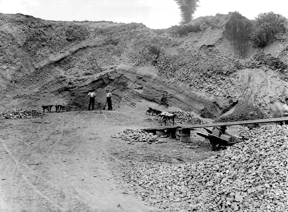
| Caption: | Cambusbarron, 1.6 km. south-west of Stirling. Stirlingshire. Pit, south-west of Birkhill, showing irregularly-bedded glacial deltaic sands and gravels which here constitute the '100 ft.' raised beach. |
| Description: | Cambusbarron, 1.6 km. south-west of Stirling. Stirlingshire. Pit, south-west of Birkhill, showing irregularly-bedded glacial deltaic sands and gravels which here constitute the '100 ft.' raised beach. The small scale of the operation is indicated by the use of hand tools and wooden wheelbarrows by the two quarrymen. The bedding is much interrupted, often rather steep and inclined in various directions. Note the sharp break between the finer material below and the coarse rounded boulders above. |
| Date taken: | Fri Jan 01 00:00:00 GMT 1926 |
| Photographer: | Manson, W. |
| Copyright statement: | Crown |
| Acknowledgment: | This image was digitized with grant-in-aid from SCRAN the Scottish Cultural Resources Access Network |
| X longitude/easting: | 277500 |
| Y latitude/northing: | 692500 |
| Coordinate reference system, ESPG code: | 27700 (OSGB 1936 / British National Grid) |
| Orientation: | Landscape |
| Size: | 356.23 KB; 1000 x 737 pixels; 85 x 62 mm (print at 300 DPI); 265 x 195 mm (screen at 96 DPI); |
| Average Rating: | Not yet rated |
| Categories: | Unsorted Images |
Loading...
Loading...
Reviews
There is currently no feedback