| P number: | P000075 |
|---|---|
| Old photograph number: | C02959 |
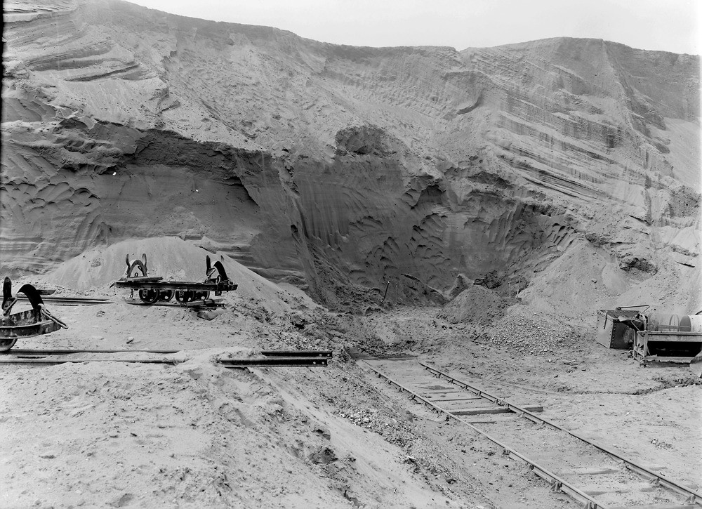
| Caption: | Ferniegair Sand-pit, 2.4 km. south-east of Hamilton. Looking south. Lanarkshire. Glacial sands and gravel of fluvioglacial origin, showing delta-like bedding. The quarry had 6-9 m. of sand with subordinate gravel and some layers of silt and clay. |
| Description: | Ferniegair Sand-pit, 2.4 km. south-east of Hamilton. Looking south. Lanarkshire. Glacial sands and gravel of fluvioglacial origin, showing delta-like bedding. The quarry had 6-9 m. of sand with subordinate gravel and some layers of silt and clay. The light railway tracks lead to the 20-30 ft. high working face. The face is worked manually with shovels, the marks from which are clearly visible. On the left at a higher level are more railway tracks with a bogie on one track. The sand and subordinate gravels were used for building and concrete sand and for horticultural sand for bedding plants. Some of the sand mixed with a bond was also used for iron moulding. |
| Date taken: | Sat Jan 01 00:00:00 GMT 1921 |
| Photographer: | Manson, W. |
| Copyright statement: | Crown |
| Acknowledgment: | This image was digitized with grant-in-aid from SCRAN the Scottish Cultural Resources Access Network |
| X longitude/easting: | 273500 |
| Y latitude/northing: | 654500 |
| Coordinate reference system, ESPG code: | 27700 (OSGB 1936 / British National Grid) |
| Orientation: | Landscape |
| Size: | 277.27 KB; 1000 x 725 pixels; 85 x 61 mm (print at 300 DPI); 265 x 192 mm (screen at 96 DPI); |
| Average Rating: | Not yet rated |
| Categories: | Unsorted Images |
Loading...
Loading...
Reviews
There is currently no feedback