| P number: | P000060 |
|---|---|
| Old photograph number: | C02886 |
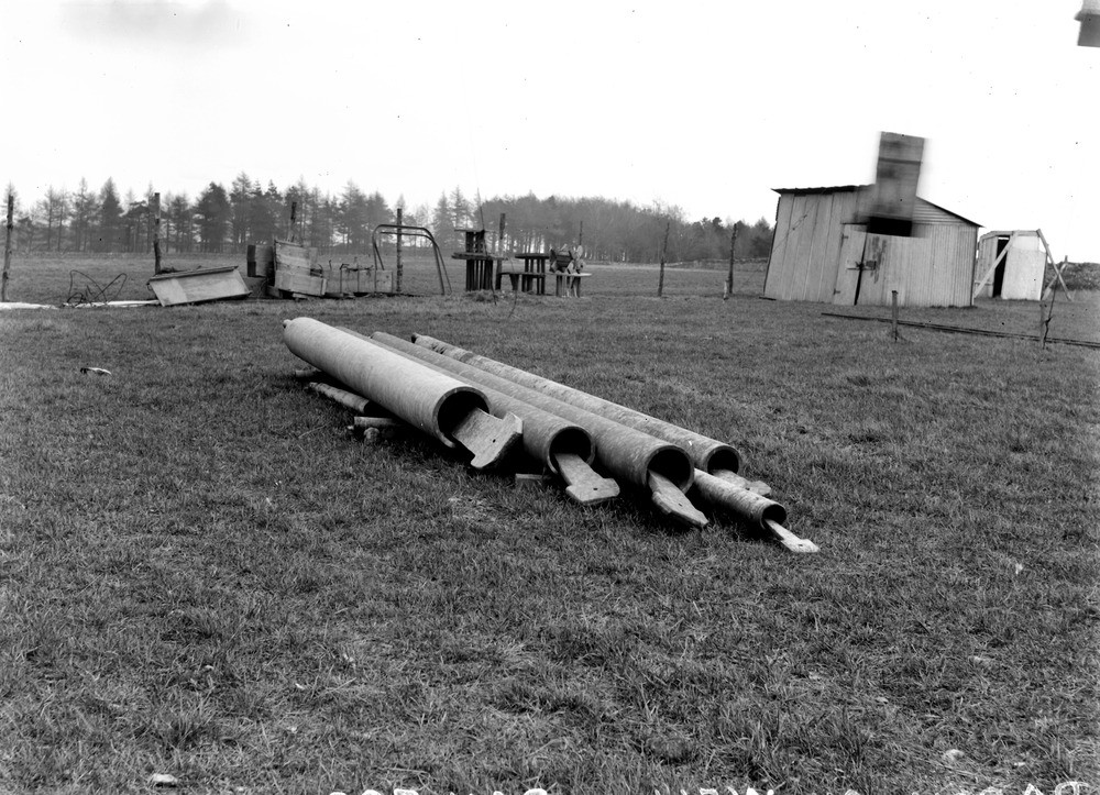
| Caption: | D'Arcy, 4.0 km. south-east of Dalkeith. Site of the exploratory oil borehole, 1919-1922 and undertaken by S. Pearson and Son Ltd. Midlothian. |
| Description: | D'Arcy, 4.0 km. south-east of Dalkeith. Site of the exploratory oil borehole, 1919-1922 and undertaken by S. Pearson and Son Ltd. Midlothian. Fine oil well 'bailers' used to extract samples of the drilled rock are shown laid out, note the different sizes. The system of drilling produced chips of rock with occasional fragments derived from cavings, mixed with crushed and pulverized detritus. Samples are secured by a baler lowered down the hole after every five feet of boring. |
| Date taken: | Sat Jan 01 00:00:00 GMT 1921 |
| Photographer: | Tait, D. |
| Copyright statement: | Crown |
| Acknowledgment: | This image was digitized with grant-in-aid from SCRAN the Scottish Cultural Resources Access Network |
| X longitude/easting: | 336500 |
| Y latitude/northing: | 634500 |
| Coordinate reference system, ESPG code: | 27700 (OSGB 1936 / British National Grid) |
| Orientation: | Landscape |
| Size: | 253.22 KB; 1000 x 723 pixels; 85 x 61 mm (print at 300 DPI); 265 x 191 mm (screen at 96 DPI); |
| Average Rating: | Not yet rated |
| Categories: | Unsorted Images, Geoscience subjects/ Economic geology/ Boring and prospecting |
Loading...
Loading...
Reviews
There is currently no feedback