| P number: | P000057 |
|---|---|
| Old photograph number: | C02883 |
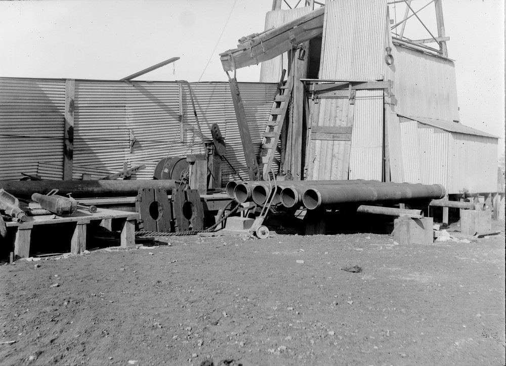
| Caption: | D'Arcy, 4.0 km. south-east of Dalkeith and 1.6 km. south-south-west of the mining village of Chesterhill. Site of borehole, 1919-1922. |
| Description: | D'Arcy, 4.0 km. south-east of Dalkeith and 1.6 km. south-south-west of the mining village of Chesterhill. Site of borehole, 1919-1922. Oil well drilling rig, near view. Showing part of derrick, two drilling 'bits' on left and six tubes of casing brought close for lowering. The casing was used to stop the country rock collapsing into the borehole. In all during two months from 22nd July to 16th September 1922, seven tons of oil were obtained from the well after which date operations were suspended. |
| Date taken: | Sat Jan 01 00:00:00 GMT 1921 |
| Photographer: | Tait, D. |
| Copyright statement: | Crown |
| Acknowledgment: | This image was digitized with grant-in-aid from SCRAN the Scottish Cultural Resources Access Network |
| X longitude/easting: | 336500 |
| Y latitude/northing: | 634500 |
| Coordinate reference system, ESPG code: | 27700 (OSGB 1936 / British National Grid) |
| Orientation: | Landscape |
| Size: | 214.81 KB; 1000 x 724 pixels; 85 x 61 mm (print at 300 DPI); 265 x 192 mm (screen at 96 DPI); |
| Average Rating: | Not yet rated |
| Categories: | Unsorted Images, Geoscience subjects/ Economic geology/ Boring and prospecting |
Loading...
Loading...
Reviews
There is currently no feedback