| P number: | P000056 |
|---|---|
| Old photograph number: | C02882 |
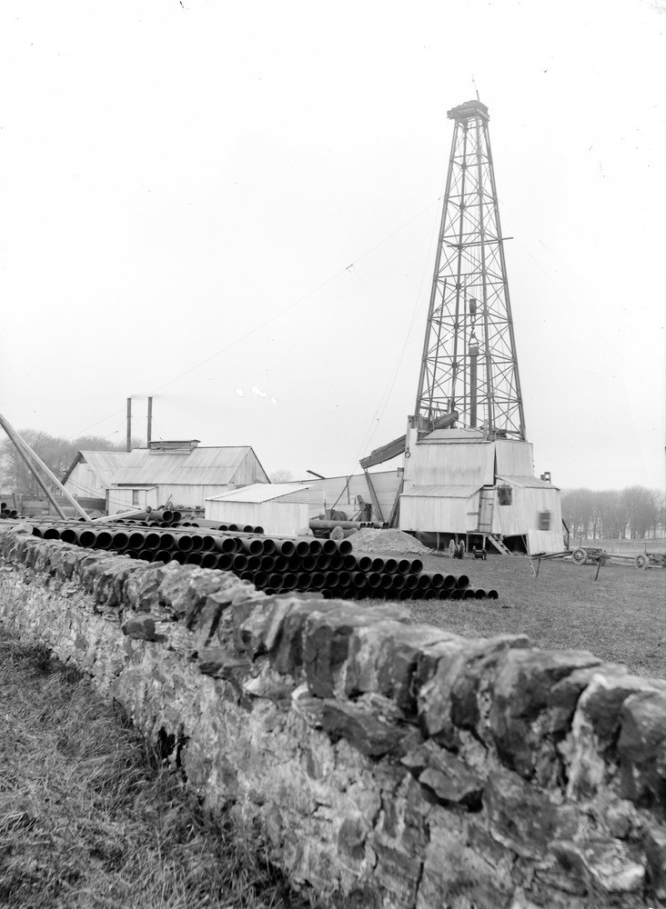
| Caption: | D'Arcy, 4.0 km. south-east of Dalkeith and 1.6 km. south-south-west of the mining village of Chesterhill. Site of borehole, 1919-1922. |
| Description: | The boring commenced on the Carboniferous Lower Limestone Group which rises as a clearly defined anticline and which was believed to be favourable to oil accumulation. The boring is situated on the crest of this anticline. The boring produced gas at 724 feet (mainly a mixture of methane and ethane). This was sealed off. At 1810 feet some good quality oil was struck in a sandstone; the bore was stopped at 1820 feet. General view of oil well drilling rig, showing derrick and pile or casing against wall in foreground. A length of casing is suspended in the derrick by the travelling block. |
| Date taken: | Sat Jan 01 00:00:00 GMT 1921 |
| Photographer: | Tait, D. |
| Copyright statement: | Crown |
| Acknowledgment: | This image was digitized with grant-in-aid from SCRAN the Scottish Cultural Resources Access Network |
| X longitude/easting: | 336500 |
| Y latitude/northing: | 634500 |
| Coordinate reference system, ESPG code: | 27700 (OSGB 1936 / British National Grid) |
| Orientation: | Portrait |
| Size: | 163.46 KB; 732 x 1000 pixels; 62 x 85 mm (print at 300 DPI); 194 x 265 mm (screen at 96 DPI); |
| Average Rating: | Not yet rated |
| Categories: | Unsorted Images, Geoscience subjects/ Economic geology/ Boring and prospecting |
Loading...
Loading...
Reviews
There is currently no feedback