| P number: | P528146 |
|---|---|
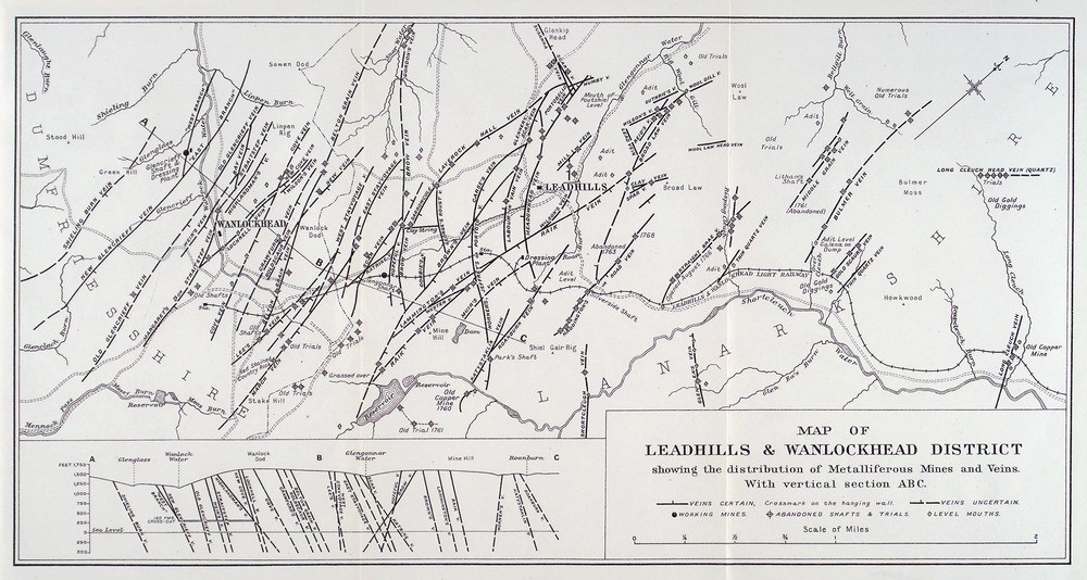
| Caption: | Map of Leadhills and Wanlockhead district showing the distribution of metalliferous mines and veins. |
| Description: | The Leadhills and Wanlockhead district contained the most productive lead mines in Scotland. The map shows the location of all the major veins, mines, levels and abandoned shafts and trials. About 70 veins are known in the area. The first recorded mining was that at the lead mine at Glengonnar (Leadhills) being worked by the monks of Newbattle in 1239 but there is little doubt that mining occurred long before then. Almost all the veins contain galena as the principal valuable mineral. Some few contain copper ores and they have been worked for them. Most veins contain zinc-blend (sphalaerite) but not usually in commercial quantities. There is also a wide distribution of alluvial gold in the area. |
| Date taken: | Sun Jun 25 00:00:00 GMT 1905 |
| Photographer: | Unknown |
| Copyright statement: | Unknown |
| Orientation: | Landscape |
| Size: | 204.38 KB; 1000 x 534 pixels; 85 x 45 mm (print at 300 DPI); 265 x 141 mm (screen at 96 DPI); |
| Average Rating: | Not yet rated |
| Categories: | Unsorted Images |
Loading...
Loading...
Reviews
There is currently no feedback