| P number: | P528071 |
|---|---|
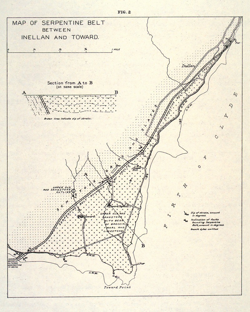
| Caption: | Map of serpentine belt between Innellan and Toward, Argyllshire. |
| Description: | Map of serpentine belt between Innellan and Toward, Argyllshire. This locality yielded talc in lenticular veins in a belt of serpentinite lying between two faults in the Highland Boundary Fault Zone extending from Innellan Pier to the shore west of Toward Point. Talc was worked at the junction of two streams north of Toward Taynuill where the late Mr. Mather produced 183 tons of the mineral in 1928-1929. Quality was good though samples show the presence of small irregular grains of magnetite and picolite under the microscope. Talc is a hydrous magnesium silicate formed from the decomposition of serpentine. It has a soft soapy feel and is usually silvery-white, green, greyish or yellowish in colour. |
| Date taken: | Sun Jun 25 00:00:00 GMT 1905 |
| Photographer: | Unknown |
| Copyright statement: | Unknown |
| Orientation: | Portrait |
| Size: | 276.98 KB; 801 x 1000 pixels; 68 x 85 mm (print at 300 DPI); 212 x 265 mm (screen at 96 DPI); |
| Average Rating: | Not yet rated |
| Categories: | Unsorted Images |
Loading...
Loading...
Reviews
There is currently no feedback