| P number: | P000465 |
|---|---|
| Old photograph number: | C01876 |
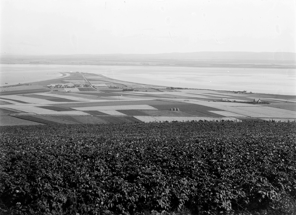
| Caption: | View from the high ground above Fortrose. Looking east. Ross & Cromarty. Part of panorama of entrance to Inverness Firth. (With C01875 and C01877.) |
| Description: | View from the high ground above Fortrose. Looking east. Ross & Cromarty. Part of panorama of entrance to Inverness Firth. (With C01875 and C01877.) Cuspate foreland of Chanonry built up of successive raised beaches, the house in centre on the 25 ft. beach, and the point beyond the 15 ft. beach. The Great Glen Fracture Zone runs parallel with the shoreline then cuts across the Chanonry foreland approximately in a position across the centre of the photograph, though there is no visible evidence of this. |
| Date taken: | Wed Jan 01 00:00:00 GMT 1913 |
| Photographer: | Lunn, R. |
| Copyright statement: | Crown |
| Acknowledgment: | This image was digitized with grant-in-aid from SCRAN the Scottish Cultural Resources Access Network |
| X longitude/easting: | 272500 |
| Y latitude/northing: | 856500 |
| Coordinate reference system, ESPG code: | 27700 (OSGB 1936 / British National Grid) |
| Orientation: | Landscape |
| Size: | 217.17 KB; 1000 x 727 pixels; 85 x 62 mm (print at 300 DPI); 265 x 192 mm (screen at 96 DPI); |
| Average Rating: | Not yet rated |
| Categories: | Unsorted Images, Geoscience subjects/ Landforms, marine/ Coastal deposition, sand-bars, shingle-ridges, storm-beaches |
Loading...
Loading...
Reviews
There is currently no feedback