| P number: | P002755 |
|---|---|
| Old photograph number: | D01598 |
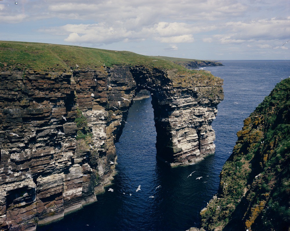
| Caption: | The Needle' from the south side of Ashy Geo, 5.633 km. south of Wick, Caithness. |
| Description: | The gently dipping rocks belong to the Ulbster/Ires Geo Sandstone Formation. The inlet or geo seen in the foreground would have formed along a line of weakness probably a vertical master joint or line of crush. Subsequent erosion concentrated on either side of the headland and exploiting cross joints would have formed at first caves, then as the caves join, formed the arch. Eventually the arch will collapse leaving an isolated sea stack. Sea cliff with arch eroded in Lower Old Red Sandstone (Devonian) purple and green mudstones. Red sandstone beds form the bridge of the arch and the upper part of the cliff. |
| Date taken: | Wed Jan 01 00:00:00 GMT 1975 |
| Photographer: | Christie, A. |
| Copyright statement: | NERC |
| Acknowledgment: | This image was digitized with grant-in-aid from SCRAN the Scottish Cultural Resources Access Network |
| X longitude/easting: | 335800 |
| Y latitude/northing: | 945000 |
| Coordinate reference system, ESPG code: | 27700 (OSGB 1936 / British National Grid) |
| Orientation: | Landscape |
| Size: | 313.96 KB; 1000 x 795 pixels; 85 x 67 mm (print at 300 DPI); 265 x 210 mm (screen at 96 DPI); |
| Average Rating: | Not yet rated |
| Categories: | Best of BGS Images/ Geological structures, Geoscience subjects/ Landforms, marine/ Natural arches, Geoscience subjects/ Named locality |
Loading...
Loading...
Reviews
There is currently no feedback