| P number: | P002237 |
|---|---|
| Old photograph number: | C02034 |
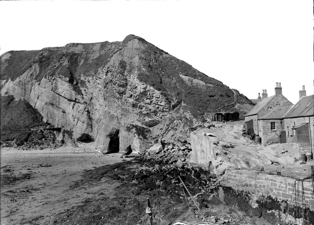
| Caption: | Cove Harbour, 1.1 km. north-east of Cockburnspath, Berwickshire. Cliff in Carboniferous sandstones. |
| Description: | Cove Harbour, 1.1 km. north-east of Cockburnspath, Berwickshire. Cliff in Carboniferous sandstones. Cliff of moderately dipping sandstones and shales of the Strathclyde Group (formerly Calciferous Sandstone Measures), overlain by glacial deposits (sand and gravel between boulder clay). The latter are poorly consolidated and have a natural slope angle of much less than vertical and the vegetation cover is probably helping to stabilize the slope. Note old sea caves at the foot of the sandstone cliff. Carboniferous strata in the Cockburnspath to Dunbar area rest on Silurian rocks of the Southern Uplands terrane and form the landward margin of a large basin which extends eastwards into the North Sea. |
| Date taken: | Thu Jan 01 00:00:00 GMT 1914 |
| Photographer: | Lunn, R. |
| Copyright statement: | Crown |
| Acknowledgment: | This image was digitized with grant-in-aid from SCRAN the Scottish Cultural Resources Access Network |
| X longitude/easting: | 378500 |
| Y latitude/northing: | 671500 |
| Coordinate reference system, ESPG code: | 27700 (OSGB 1936 / British National Grid) |
| Orientation: | Landscape |
| Size: | 256.25 KB; 1000 x 716 pixels; 85 x 61 mm (print at 300 DPI); 265 x 189 mm (screen at 96 DPI); |
| Average Rating: | Not yet rated |
| Categories: | Unsorted Images, Geoscience subjects/ Stratigraphical |
Loading...
Loading...
Reviews
There is currently no feedback