| P number: | P002219 |
|---|---|
| Old photograph number: | C01998 |
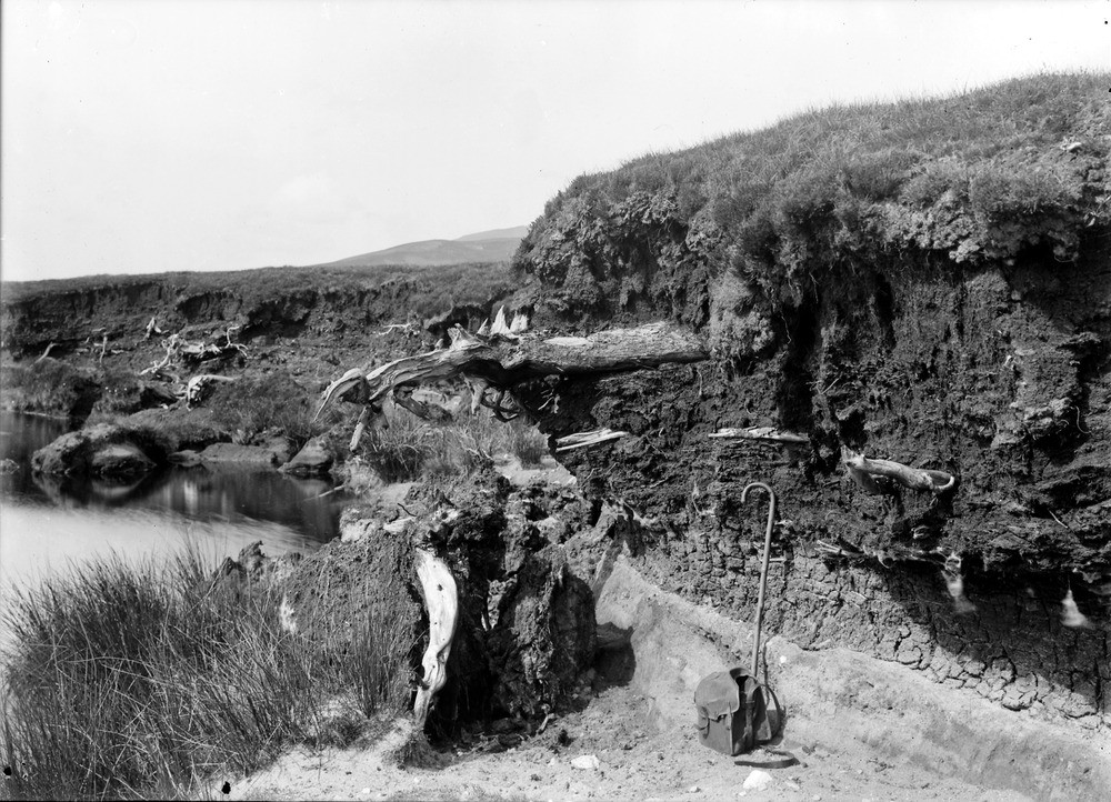
| Caption: | Allt Airidh-dhamh, 4.0 km. north-west of Kinbrace, Sutherland. Section in peat showing remains of successive forest growths. |
| Description: | Allt Airidh-dhamh, 4.0 km. north-west of Kinbrace, Sutherland. Section in peat showing remains of successive forest growths. After the final disappearance of the ice from the last glaciation, heath was re-established followed by birch and pine forests. When a wetter and cooler climate initiated at about 6000 years ago, part of the forest was destroyed by blanket peat. This section of peat is part of the largest and most complete area of blanket bog in Scotland. The succession of plant remains in the peat mosses of Caithness/Sutherland have been summarized as follows: the first growth has been dwarf willows formed under sub-arctic conditions. This is followed in upward succession by remains of birch and locally hazel, this forming the base of the peat when the willow is absent. Higher up in the peat comes a pine forest covered by the top layers of the mosses. |
| Date taken: | Thu Jan 01 00:00:00 GMT 1914 |
| Photographer: | Lunn, R. |
| Copyright statement: | Crown |
| Acknowledgment: | This image was digitized with grant-in-aid from SCRAN the Scottish Cultural Resources Access Network |
| X longitude/easting: | 284500 |
| Y latitude/northing: | 934500 |
| Coordinate reference system, ESPG code: | 27700 (OSGB 1936 / British National Grid) |
| Orientation: | Landscape |
| Size: | 271.82 KB; 1000 x 722 pixels; 85 x 61 mm (print at 300 DPI); 265 x 191 mm (screen at 96 DPI); |
| Average Rating: | Not yet rated |
| Categories: | Unsorted Images, Geoscience subjects/ Stratigraphical |
Loading...
Loading...
Reviews
There is currently no feedback