| P number: | P222960 |
|---|---|
| Old photograph number: | L02447 |
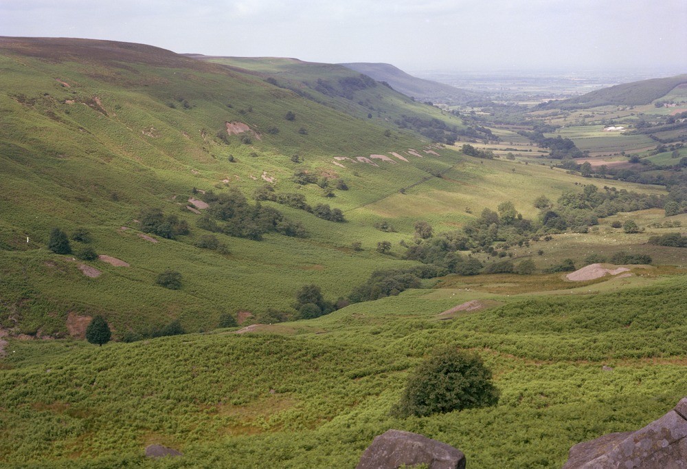
| Caption: | Scugdale. |
| Description: | Scugdale. General view of the western side of Scugdale showing the Jet Shale (Lias) tips scarring the lower slopes of the valley. A marked steepening of the valley side occurs where the Middle Jurassic sandstones form a series of bench-like features. Kendall (1902) described this valley as one of several in the Cleveland Hills occupied by a glacier lake, dammed by ice to the north. The Teesside Plain can be seen stretching away to the north-west. |
| Date taken: | Tue Jul 01 00:00:00 BST 1980 |
| Photographer: | Thornton, K.E. |
| Copyright statement: | NERC |
| X longitude/easting: | 452900 |
| Y latitude/northing: | 499200 |
| Coordinate reference system, ESPG code: | 27700 (OSGB 1936 / British National Grid) |
| Orientation: | Landscape |
| Size: | 232.78 KB; 1000 x 682 pixels; 85 x 58 mm (print at 300 DPI); 265 x 180 mm (screen at 96 DPI); |
| Average Rating: | Not yet rated |
| Categories: | Unsorted Images |
Loading...
Loading...
Reviews
There is currently no feedback