| P number: | P222958 |
|---|---|
| Old photograph number: | L02445 |
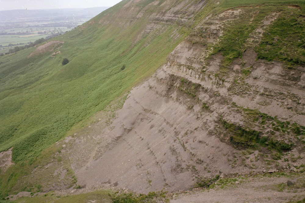
| Caption: | Tom Gill, near Carlton. Looking E. |
| Description: | Tom Gill, near Carlton. Looking E. Northern scarp of the Cleveland Hills. Eastern side of Tom Gill showing a predominantly mudstone/siltstone sequence in the lower part of the section (Lower Lias). The resistant bands are formed by ironstone nodules. The more massive central portion comprises sandstones, siltstones and limestone of the Staithes Formation (Middle Lias) which passes up into mudstones with thin sandstones and ironstones of the Cleveland Ironstone Formation. Much of the scarp is mantled by landslips. |
| Date taken: | Tue Jul 01 00:00:00 BST 1980 |
| Photographer: | Thornton, K.E. |
| Copyright statement: | NERC |
| X longitude/easting: | 452700 |
| Y latitude/northing: | 503200 |
| Coordinate reference system, ESPG code: | 27700 (OSGB 1936 / British National Grid) |
| Orientation: | Landscape |
| Size: | 240.29 KB; 1000 x 665 pixels; 85 x 56 mm (print at 300 DPI); 265 x 176 mm (screen at 96 DPI); |
| Average Rating: | Not yet rated |
| Categories: | Unsorted Images |
Loading...
Loading...
Reviews
There is currently no feedback