| P number: | P001650 |
|---|---|
| Old photograph number: | MNS02064 |
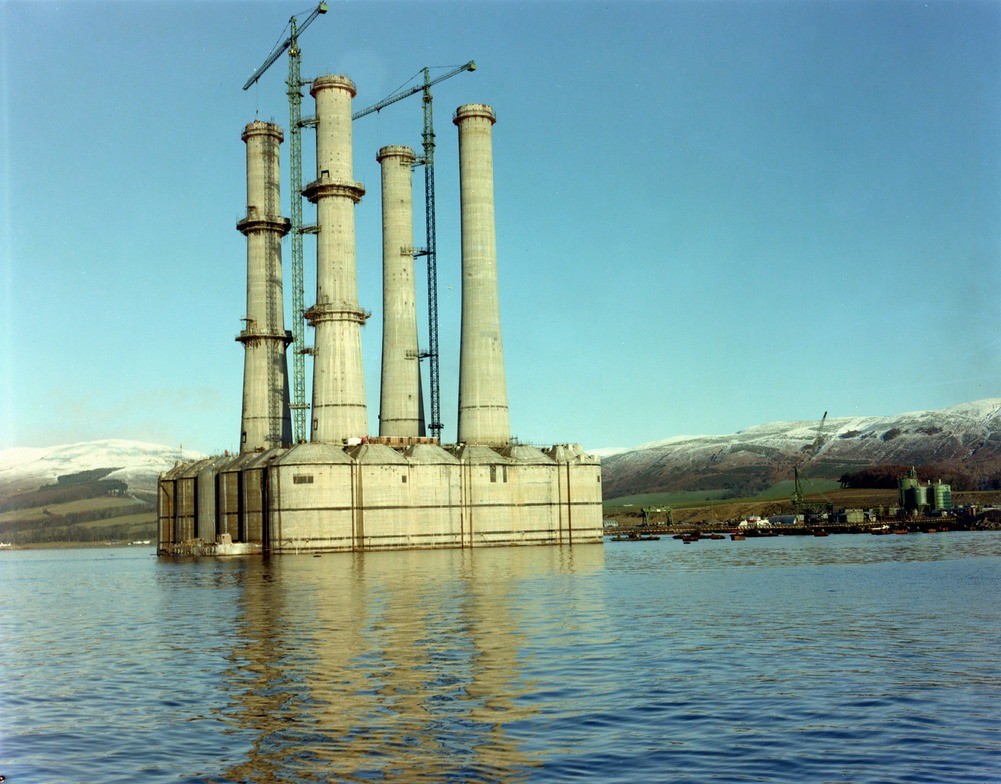
| Caption: | Ardyne Point, oil platform construction at Ardyne Point, Strathclyde Region. A full view of the part-completed platform. |
| Description: | Ardyne Point, oil platform construction at Ardyne Point, Strathclyde Region. A full view of the part-completed platform. Following initial construction of the massive bases, the platforms are moored to an adjacent jetty to have the legs formed on top. The partly-completed platforms would then have been towed to deeper water installations at Loch Fyne or Inner Sound off Kyle of Lochalsh where submersion tests were performed and the deck units floated on top. Initially there was little development of oil and gas-related industries on the west coast of Scotland. Development came at a later stage. 1974 found a remarkable outburst of interest by prospective platform constructors in the Firth of Clyde, attracted by the deep waters of the Clyde and the sea lochs and the proximity to a large potential labour force, and nearby supplies of steel and aggregates. Ardyne Point, the key site in the area, received its first contract to build a platform in January 1974, other orders soon followed and construction of the site began. |
| Date taken: | Sat Jan 01 00:00:00 GMT 1977 |
| Photographer: | Unknown |
| Copyright statement: | Unknown |
| Acknowledgment: | This image was digitized with grant-in-aid from SCRAN the Scottish Cultural Resources Access Network |
| X longitude/easting: | 209500 |
| Y latitude/northing: | 667800 |
| Coordinate reference system, ESPG code: | 27700 (OSGB 1936 / British National Grid) |
| Orientation: | Landscape |
| Size: | 206.49 KB; 1001 x 784 pixels; 85 x 66 mm (print at 300 DPI); 265 x 207 mm (screen at 96 DPI); |
| Average Rating: | Not yet rated |
| Categories: | Best of BGS Images/ Industrial geology |
Loading...
Loading...
Reviews
There is currently no feedback