| P number: | P222619 |
|---|---|
| Old photograph number: | L01817 |
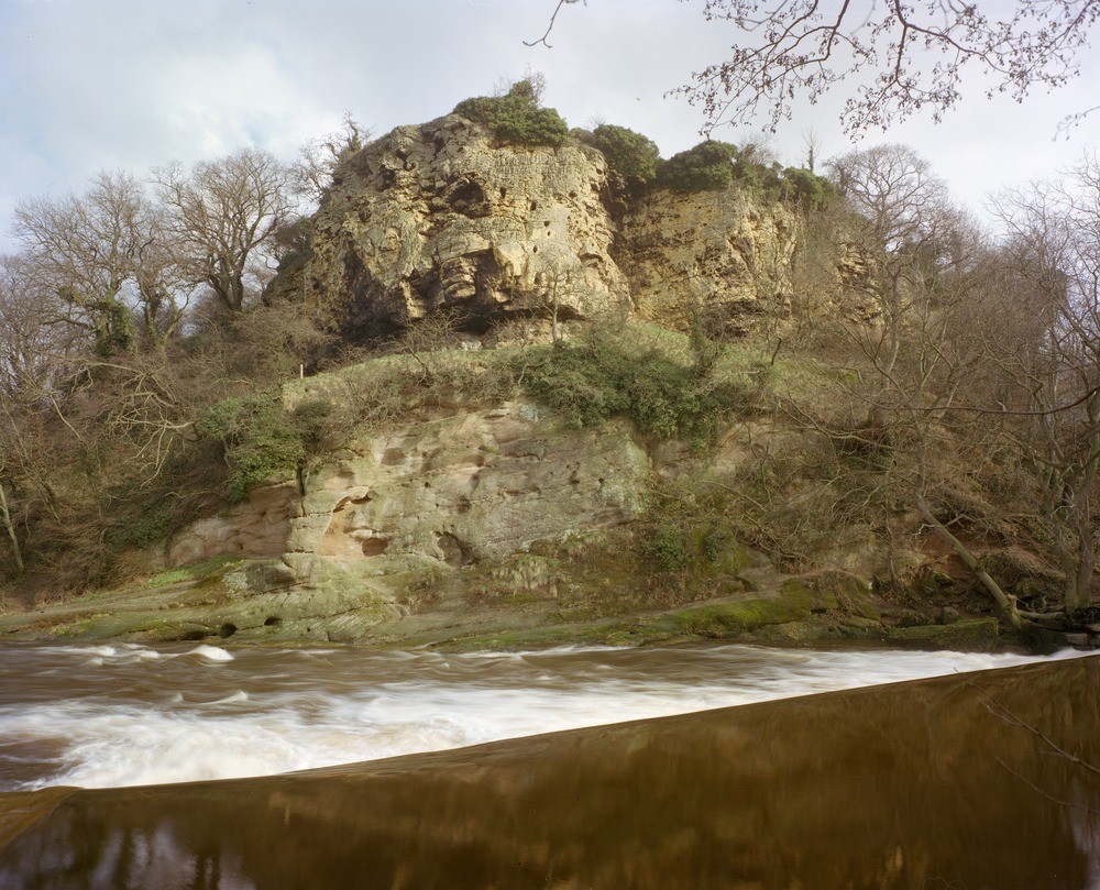
| Caption: | 50 m W. of Grimbald Crag, Knaresborough. Looking SE. |
| Description: | 50 m W. of Grimbald Crag, Knaresborough. Looking SE. The Carboniferous/Permian unconformity at Grimbald Crag, Knaresborough. Oolitic limestones of the Lower Magnesian Limestone - Upper Subdivision rest unconformably upon a buried hill of slightly reddened Upper Plompton Grit (Namurian). |
| Date taken: | Wed Feb 01 00:00:00 GMT 1978 |
| Photographer: | Thornton, K.E. |
| Copyright statement: | NERC |
| X longitude/easting: | 436050 |
| Y latitude/northing: | 455760 |
| Coordinate reference system, ESPG code: | 27700 (OSGB 1936 / British National Grid) |
| Orientation: | Landscape |
| Size: | 274.87 KB; 1000 x 809 pixels; 85 x 68 mm (print at 300 DPI); 265 x 214 mm (screen at 96 DPI); |
| Average Rating: | Not yet rated |
| Categories: | Unsorted Images |
Loading...
Loading...
Reviews
There is currently no feedback