| P number: | P001284 |
|---|---|
| Old photograph number: | D05489 |
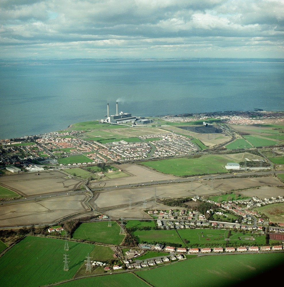
| Caption: | Oblique aerial view of Bankpark, part of Tranent, the A1 trunk road, Cockenzie with Power Station, and the Fife skyline across the Firth of Forth along the top, looking from the south. |
| Description: | Oblique aerial view of Bankpark, part of Tranent, the A1 trunk road, Cockenzie with Power Station, and the Fife skyline across the Firth of Forth along the top, looking from the south. The foreground is arable land and part of Tranent on moundy glacial deposits. Beyond the A1 Tranent By-pass, the generally flattish areas are the late-glacial raised beach, with good rich fine sand to clay soils, forming good arable land, but gradually being built on by Cockenzie and Port Seton. The coal-fired Cockenzie Power Station on the coast is built on made ground reclaimed from the intertidal flats. The coal storage area and rail links from the former Monktonhall Colliery are seen in front. |
| Date taken: | Wed May 01 00:00:00 BST 1996 |
| Photographer: | Bain, T.S. |
| Copyright statement: | NERC |
| Acknowledgment: | This image was digitized with grant-in-aid from SCRAN the Scottish Cultural Resources Access Network |
| X longitude/easting: | 339500 |
| Y latitude/northing: | 673000 |
| Coordinate reference system, ESPG code: | 27700 (OSGB 1936 / British National Grid) |
| Orientation: | Portrait |
| Size: | 346.15 KB; 989 x 1000 pixels; 84 x 85 mm (print at 300 DPI); 262 x 265 mm (screen at 96 DPI); |
| Average Rating: | Not yet rated |
| Categories: | Best of BGS Images/ Industrial geology |
Loading...
Loading...
Reviews
There is currently no feedback