| P number: | P000024 |
|---|---|
| Old photograph number: | C02164 |
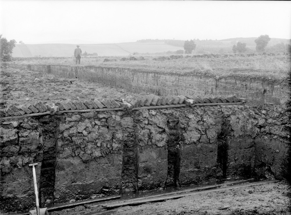
| Caption: | Black Moss, 2.4 km. north of Dinnet Station. Aberdeenshire.The kieselguhr (diatomite) works. |
| Description: | Black Moss, 2.4 km. north of Dinnet Station. Aberdeenshire.The kieselguhr (diatomite) works. Kieselguhr overlain by peat marking site of silted-up lake. The vertical trenches show the method of draining the peat. Recently-cut blocks can be seen as well as rails of a light railway. The moor of Dinnet is a glacial basin feature containing low ridges of sands and gravels interspersed by depressions occupied by lochs and peat bogs (mosses). The diatomite occurs below the peat in these lochs and mosses. |
| Date taken: | Mon Jan 01 00:00:00 GMT 1917 |
| Photographer: | Lunn, R. |
| Copyright statement: | Crown |
| Acknowledgment: | This image was digitized with grant-in-aid from SCRAN the Scottish Cultural Resources Access Network |
| X longitude/easting: | 346500 |
| Y latitude/northing: | 801500 |
| Coordinate reference system, ESPG code: | 27700 (OSGB 1936 / British National Grid) |
| Orientation: | Landscape |
| Size: | 249.16 KB; 1000 x 739 pixels; 85 x 63 mm (print at 300 DPI); 265 x 196 mm (screen at 96 DPI); |
| Average Rating: | Not yet rated |
| Categories: | Best of BGS Images/ Images from the archives, Geoscience subjects/ Economic geology/ Diatomite, Geoscience subjects/ Economic geology/ Diatomaceous earth |
Loading...
Loading...
Reviews
There is currently no feedback