| P number: | P000284 |
|---|---|
| Old photograph number: | B00657 |
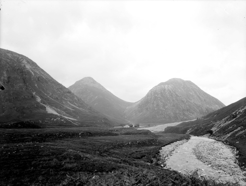
| Caption: | View from 1 m. below Dalness, Glen Etive. Looking north-north-east. Argyllshire. The south end of the two Buchailles of Etive (953.72 m.) and (950.98 m.) separated by the Lairig Gartain which follows a north-north-east shatter belt. |
| Description: | View from 1 m. below Dalness, Glen Etive. Looking north-north-east. Argyllshire. The south end of the two Buchailles of Etive (953.72 m.) and (950.98 m.) separated by the Lairig Gartain which follows a north-north-east shatter belt. The hills are composed of rhyolite and andesite of Lower Old Red Sandstone age, invaded by Cruachan granite. River terraces backed by moraines in the foreground. Rhyolites are fine-grained to glassy acid igneous rocks. Andesites are fine-grained intermediate volcanic igneous rocks. A river terrace marks the position of a former flood plain when the river flowed at a higher level and before downcutting of the river. |
| Date taken: | Wed Jan 01 00:00:00 GMT 1896 |
| Photographer: | Lunn, R. |
| Copyright statement: | Crown |
| Acknowledgment: | This image was digitized with grant-in-aid from SCRAN the Scottish Cultural Resources Access Network |
| X longitude/easting: | 216000 |
| Y latitude/northing: | 750000 |
| Coordinate reference system, ESPG code: | 27700 (OSGB 1936 / British National Grid) |
| Orientation: | Landscape |
| Size: | 154.09 KB; 1000 x 756 pixels; 85 x 64 mm (print at 300 DPI); 265 x 200 mm (screen at 96 DPI); |
| Average Rating: | Not yet rated |
| Categories: | Unsorted Images, Geoscience subjects/ Landforms, river/ River terraces and cliffs |
Loading...
Loading...
Reviews
There is currently no feedback