0
/
selected
Loading...
Loading...
Loading...
Loading...
- Default
- Number of Views
- Number of Downloads
- Acknowledgment
- Additional information
- Associate
- Average Rating
- Caption
- Collection ID number
- Coordinate reference system, ESPG code
- Copyright note
- Copyright statement
- Date taken
- Description
- Image rating
- Jpeg2000 link
- Old photograph number
- Orientation
- P number
- Photographer
- Science rating
- Size
- X longitude/easting
- Y latitude/northing
| P number | Caption | Actions | ||
|---|---|---|---|---|
|
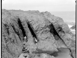
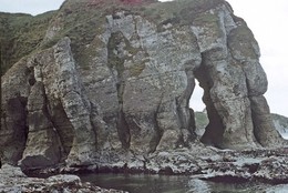
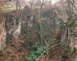
P002629 | Holes of Scraada, Eshaness, Mainland,... | View details Add to lightbox Remove from lightbox | |
|
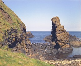
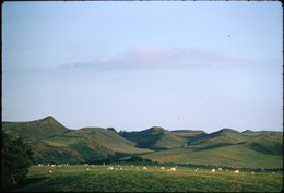
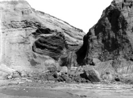
P002642 | Bight of Haggrister, looking south,... | View details Add to lightbox Remove from lightbox | |
|
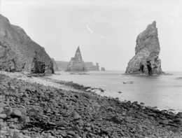
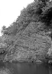
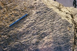
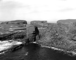
P002738 | Fair Isle, Bu Ness, north face of... | View details Add to lightbox Remove from lightbox | |
|
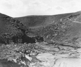
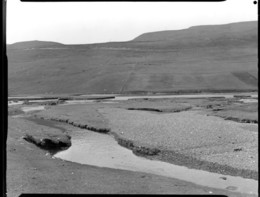
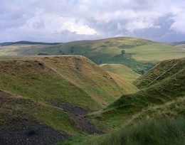
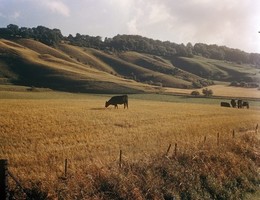
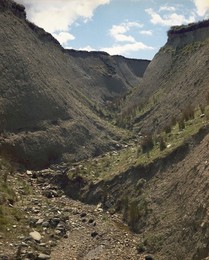
P002866 | Glen Quey, looking east, 6 km.... | View details Add to lightbox Remove from lightbox | |
|
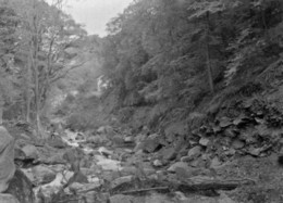
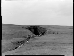
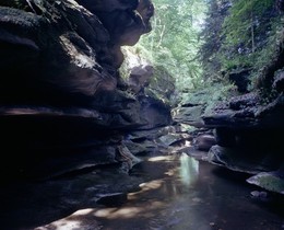
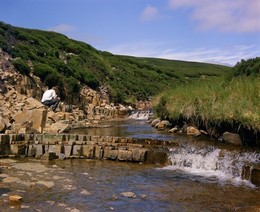
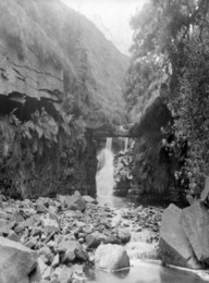
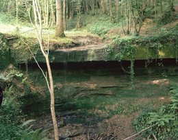
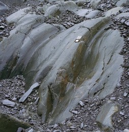
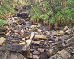
P005478 | How Stean Gorge, Lofthouse, Nidderdale.... | View details Add to lightbox Remove from lightbox | |
|
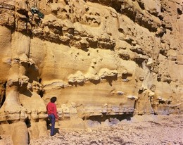
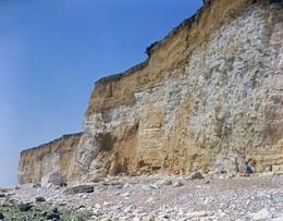
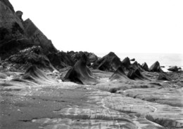
P005797 | Eastern side of West Bay. Looking E. | View details Add to lightbox Remove from lightbox | |
|
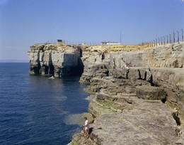
P005821 | Portland Bill, Portland. Looking N. | View details Add to lightbox Remove from lightbox | |
|
P006478 | Portnaboe. Looking N. | View details Add to lightbox Remove from lightbox | |
|
P006812 | Cliffs 350 metres NE of Haddocks... | View details Add to lightbox Remove from lightbox | |
|
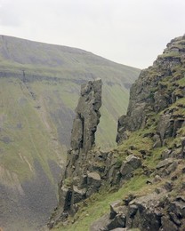
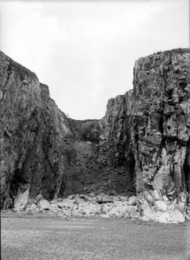
P007523 | High Cup Gill. Looking S. | View details Add to lightbox Remove from lightbox | |
|
P007527 | Arngill Beck, Brough. Looking NW. | View details Add to lightbox Remove from lightbox | |
|
P007976 | 400 m. NW of Nant-y-fedwen, 3.2 km. E.... | View details Add to lightbox Remove from lightbox | |
|
P008352 | Borve, Isle of Barra. | View details Add to lightbox Remove from lightbox | |
|
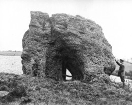
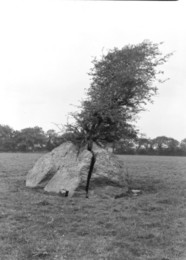
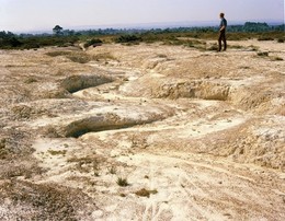
P020152 | In field, 1/2 m. W. of Blidworth... | View details Add to lightbox Remove from lightbox | |
|
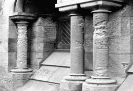
P023994 | St. Peter's Church, Easton, Portland. | View details Add to lightbox Remove from lightbox | |
|
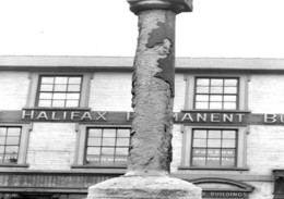
P024024 | Market Place, Mansfield. | View details Add to lightbox Remove from lightbox | |
|
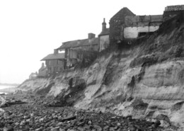
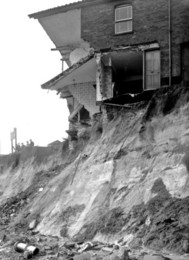
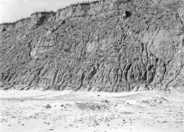
P025917 | Pakefield, about 1,25 miles south of... | View details Add to lightbox Remove from lightbox | |
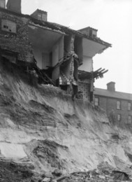
|
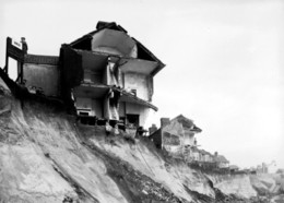
P025918 | Pakefield, about 1,25 miles south of... | View details Add to lightbox Remove from lightbox | |
|
P025919 | Pakefield, about 1,25 miles south of... | View details Add to lightbox Remove from lightbox | |
|
P025920 | Pakefield, about 1,25 miles south of... | View details Add to lightbox Remove from lightbox | |
|
P040745 | Banks Gill, Draughton. | View details Add to lightbox Remove from lightbox | |
|
P200287 | Frank's Shore, Tenby. Looking N. | View details Add to lightbox Remove from lightbox | |

|
P201164 | In field, 1/2 m. W. of Blidworth... | View details Add to lightbox Remove from lightbox | |
|
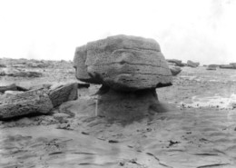
P201469 | Boulder, W. by N. from Trefarthen.... | View details Add to lightbox Remove from lightbox | |
|
P201770 | Compton Chine, about 1 m. NW of Hanover... | View details Add to lightbox Remove from lightbox | |
|
P203502 | Blackstone Edge. Looking NW. | View details Add to lightbox Remove from lightbox | |
|
P203576 | Marsden Clough, Holmbridge (about 1 m.... | View details Add to lightbox Remove from lightbox | |
|
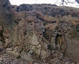
P209600 | Bellhurst Wood, NW of Hurst Green.... | View details Add to lightbox Remove from lightbox | |
|
P209647 | Roadside below White Horse, Westbury.... | View details Add to lightbox Remove from lightbox | |
|
P209860 | W. of Cuckmere Haven. Looking WSW. | View details Add to lightbox Remove from lightbox | |
|
P210202 | Ashdown Forest, S. of Wych Cross. | View details Add to lightbox Remove from lightbox | |
|
P210328 | Denny Bottom, 1 m. W. of Tunbridge Wells. | View details Add to lightbox Remove from lightbox | |
|
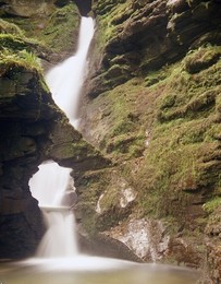
P210439 | View from footpath at St. Nectan's... | View details Add to lightbox Remove from lightbox | |
|
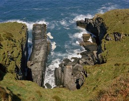
P210456 | View from the cliff path immediately S.... | View details Add to lightbox Remove from lightbox | |
|
P211607 | Hope Gap, near Cuckmere Haven. | View details Add to lightbox Remove from lightbox | |
|
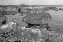
P218262 | Shore at Ardross. | View details Add to lightbox Remove from lightbox | |
|
P218515 | Papa Stour, N. shore of Hirdie Geo. | View details Add to lightbox Remove from lightbox | |
|
P221787 | Rombalds Moor 2 m. S. of Addingham,... | View details Add to lightbox Remove from lightbox | |
|
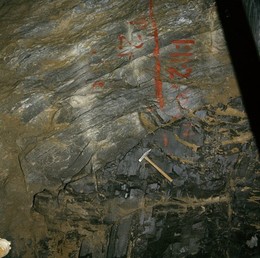
P222283 | Boulby Potash Mine, shaft bottom access... | View details Add to lightbox Remove from lightbox | |
|
P223095 | Floor of Llyn Peris 700 m. SE of... | View details Add to lightbox Remove from lightbox | |
|
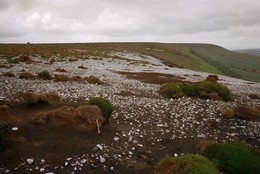
P223099 | Black Hambleton. | View details Add to lightbox Remove from lightbox | |
|
P224962 | Sliderry Cove. Looking W. | View details Add to lightbox Remove from lightbox | |
|
P224969 | The Highlandman's Bonnet. Looking NW. | View details Add to lightbox Remove from lightbox | |
|
P225033 | Alt-fraechan Glen, Redhall, Ballycarry.... | View details Add to lightbox Remove from lightbox | |
|
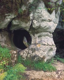
P225295 | Marble Arch, County Fermanagh. | View details Add to lightbox Remove from lightbox | |
|
P225340 | Corby Spink, Glenoo, near Fivemiletown,... | View details Add to lightbox Remove from lightbox | |
|
P225428 | Legacurry. Looking S. | View details Add to lightbox Remove from lightbox | |
|
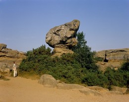
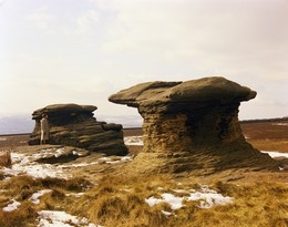
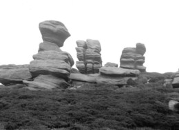
P204681 | Rocking Stones, Howden Moors, 3 1/2 m.... | View details Add to lightbox Remove from lightbox | |
|
P204890 | Portland Bill, Portland. Looking N. | View details Add to lightbox Remove from lightbox | |
|
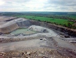
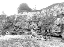
P204975 | Old quarry, The Grives,... | View details Add to lightbox Remove from lightbox | |
|
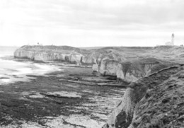
P205382 | Selwick's Bay, Flamborough. Looking SE. | View details Add to lightbox Remove from lightbox | |
|
P205467 | On foreshore, Sheepstones. Looking E. | View details Add to lightbox Remove from lightbox | |
|
P205603 | Corton Cliffs, 1 m. SE of Hopton.... | View details Add to lightbox Remove from lightbox | |
|
P205907 | On foreshore, below Torrs Walk, W. of... | View details Add to lightbox Remove from lightbox | |
|
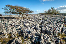
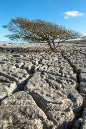
P689722 | Limestone pavement developed on the... | View details Add to lightbox Remove from lightbox | |
|
P689724 | Limestone pavement developed on the... | View details Add to lightbox Remove from lightbox | |
|
P206664 | Chiddingly Wood, West Hoathly. Looking... | View details Add to lightbox Remove from lightbox | |
|
P206870 | Parkfield, about 1 1/4 m. S. of... | View details Add to lightbox Remove from lightbox | |
|
P207177 | Bank Gill, Draughton. Looking E. | View details Add to lightbox Remove from lightbox | |
|
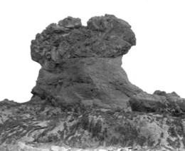
P207212 | Doubler Stones, Rombalds Moor, 2 m. S.... | View details Add to lightbox Remove from lightbox |